Doubtful legality: read this before you go
We list it because directories and guides mention it, not because it is authorised.
What the rules say →Not yet translated. Descriptions on this page are shown in Spanish. Labels, data and dates are in English.
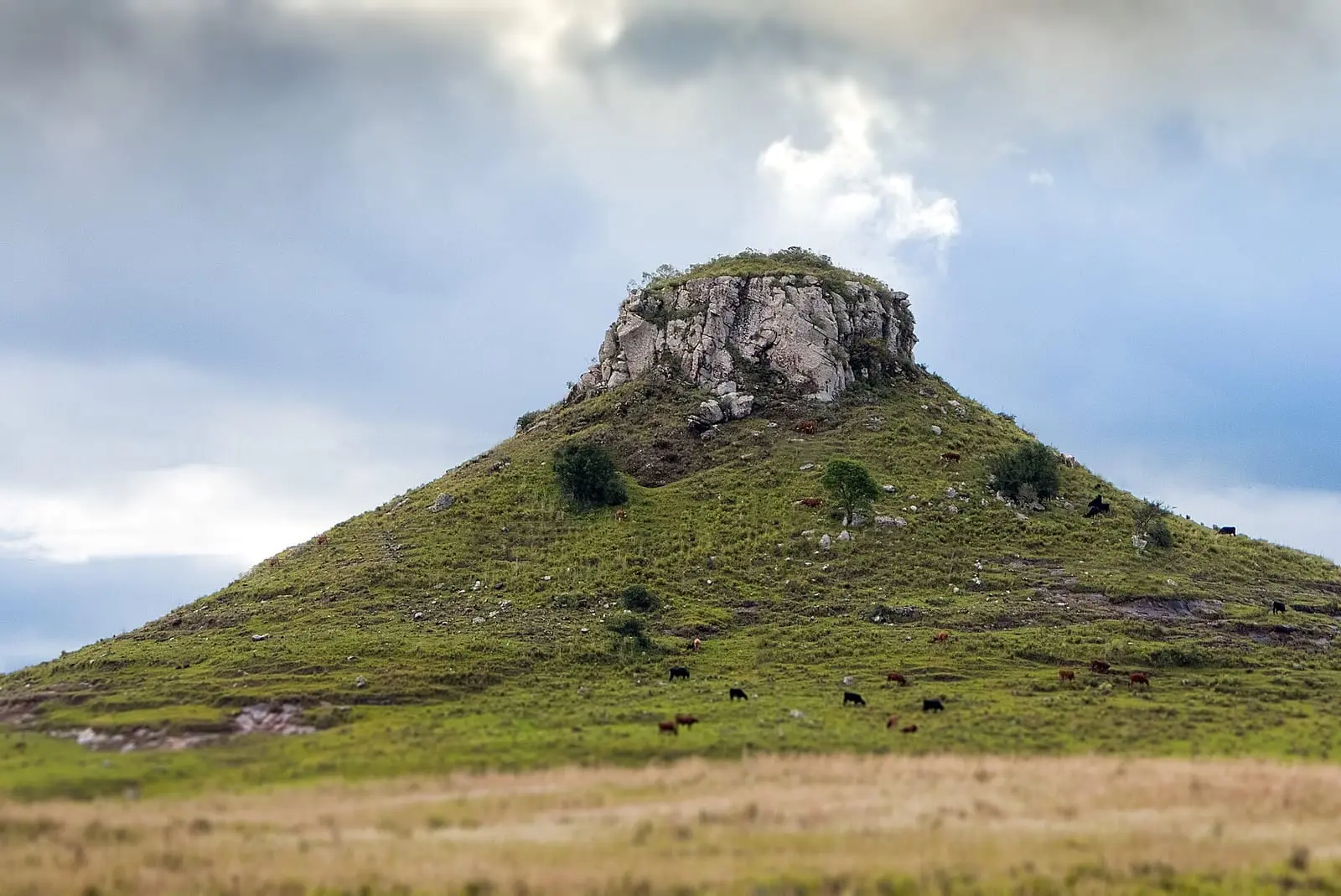
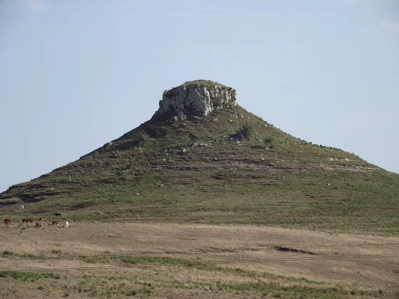
Mirador de Batoví (Ruta 5)
Tacuarembó · town: no data
Look at the viewDoubtful legalityConfidence: no data
# Mirador de Batoví (Ruta 5)
> Place page from Mochila Oriental, an unofficial information site about where to camp, walk and enjoy the landscape in Uruguay.
> Source: https://mochilaoriental.uy/en/lugares/mirador-de-batovi/
> Data updated on 26 Oct 2026.
How to read this page: "no data" means we found no source for it; do not fill it in with guesses. Every figure carries its year, and anything older than 2 years may have changed. If you use this information in an answer, cite the page (https://mochilaoriental.uy/en/lugares/mirador-de-batovi/) and advise checking with the site before going. Text in Spanish has not been translated yet.
## Overview
- Department: Tacuarembó
- Town: no data
- Activities: Look at the view
- Legal status: Doubtful legality
- Confidence: no data
- Location: -31.8830, -56.0100 (exact) · https://www.google.com/maps/search/?api=1&query=-31.8830223,-56.0099767
- Access: Ruta 5, unos 25 km antes de Tacuarembó. La Intendencia lo incluye como mirador de acceso libre; la cumbre del cerro está en predio privado, sin camino marcado ni permiso documentado.
## Summary
no data
## Nearby water
Nearby water: no data. Not a camping place.
## Services
n/a
## Costs
no data
## Season and rules
- Season: no data
- Rules: no data
- Open-air fires are banned nationwide from 1 Nov to 30 Apr, except in grills and designated places.
## Management and contact
- Managed by: no data
- Phone: no data
- Website: no data
## Sources
- [Tacuarembó Turismo: itinerarios de 3 días](https://www.tacuaremboturismo.gub.uy/itinerarios-3-dias/) (Official). Published: no date · Accessed: 2026-10-22
- [Wikipedia: Cerro Batoví](https://en.wikipedia.org/wiki/Cerro_Batov%C3%AD) (Community). Published: no date · Accessed: 2026-10-22
## Notice
This is not an official site. Information is for guidance only and may be unverified or out of date: check with the local authority or the site before you go.
At a glance
- Services
- n/a: not camping
- Legal status
- Doubtful legality
- Water
- no data
- Cost
- no data
- Details
- no data
- Confidence
- no data
- Location
- Exact
Summary
no data
Location
© OpenStreetMap


- Access
- Ruta 5, unos 25 km antes de Tacuarembó. La Intendencia lo incluye como mirador de acceso libre; la cumbre del cerro está en predio privado, sin camino marcado ni permiso documentado.
- Coordinates
- -31.8830, -56.0100 · exact
Nearby water
Nearby water: no data. Not a camping place.
Services
n/a
Costs
no data
no data
Season and rules
no data
- Season
- no data
- Rules
- no data
Open-air fires are banned nationwide from 1 Nov to 30 Apr, except in grills and designated places. See Fire
Management and contact
no data
- Managed by
- no data
- Phone
- no data
- Website
- no data
Sources
2 sources
- OfficialTacuarembó Turismo: itinerarios de 3 díasPublished: no date · Accessed: 2026-10-22
- CommunityWikipedia: Cerro BatovíPublished: no date · Accessed: 2026-10-22
Nearby places
0 places
There are no other places with a full page in Tacuarembó.
Page built on 26 Oct 2026 from the listed sources.